You are using an insecure version of your web browser. Please update your browser!
Using an outdated browser makes your computer unsafe. For a safer, faster, more enjoyable user experience, please update your browser today or try a newer browser.
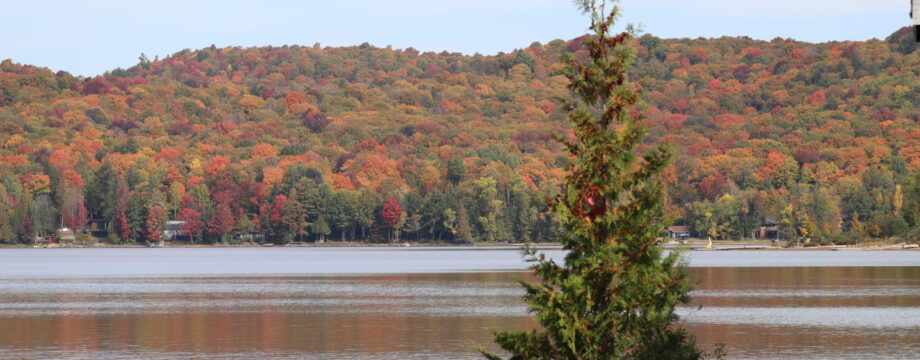
Well the original goal was to reach all three Canadian Oceans on this road trip but alas, funding ran short. Once I was back in Ontario, I was able to assess where I was, how much farther there was to go, and how much it would cost, and I simply didn’t have the funds left to do the east coast section as well.
Well…I could have made it but I wouldn’t have enjoyed it. It would have been a difficult push to reach Nova Scotia, spend a couple nights there at a friends place, then turn around and go home.
You can’t just go to Nova Scotia and not spend a few days exploring the whole Province and especially Halifax. You also can’t drive to the east coast and miss out on Newfoundland, PEI, and of course more whale watching. I’ve always believed that if you’re going to do something, it doesn’t have to be perfect, but don’t do a half-ass job of it.
So after six weeks, and just over 17,300km (10,750miles), it was time to pack it in for this road trip.
The rest of the trip is on hold for next year but I can also see myself doing many more road trips like this. In fact, I have a short trip planned to Quebec in just a couple weeks for an RC race.
A huge thanks to MySIM, CarControlSchool, Ronin Automotive, McFadden Cottages, Goodyear, WrapWerks, and the many individuals who pitched in personally to make this trip happen.
It could be constant daylight, or or constant darkness, depending of the time or year. Extremely cold, or mild and pleasant. If you’re an Entomologist you will love being swarmed by bugs of the greatest diversity. By that I mean…if it flies and is found in Canada…you will find it here. Mosquitos, Bull Flies, Black Flies, Deer Flies, Bees, Wasps, Gnats, Jiggers, No-See-Ums, and what the hell kind of beetle was that…some sort of Long Horn? I’m not an Entomologist so what do I know.
On the more pleasant side is seeing all the bears, caribou and LOTS of Bison. You really need to be careful when slowing down to get a better look at these animals though. The Black Bears are by nature very skittish and don’t like being approached. They usually bolt into the bush long before you get close enough for a good look, but the ones that don’t…be very careful. These bears are probably more accustomed to humans but if they feel threatened, even a little, you will regret having slowed down for a better look. If you aren’t very familiar with bear behaviour, do NOT get out of your vehicle to get a closer picture. Fortunately I am familiar enough with black bears to get close enough for some great pics but not close enough to upset them or put myself in harms way.
Bison are quite different though and there are lots of them to be seen beside, or even on, the road. They are quite tolerant of cars but they have a very short fuse and they can charge without warning. Do not get out of your car period. It’s very common to come across one to three teenage males hanging out on the road and although they tolerate your vehicle slowing down, they have little patience for humans who get out for a closer look or for vehicles that linger to close for to long. Those horns will mess you up badly, and they will puncture your vehicle (and you) with ease.
The view from the “Rock” at the Bush Pilots Monument in Yellowknife, NWT
The city of Yellowknife was originally a gold mining town and is now the capital of the North West Territories, but in general it’s a small place with little to see. There is a large military presence though with the Joint Task Force being stationed there. Although it doesn’t seem like a place for typical military operations, it is a good spot for various training exercises (especially cold weather survival) and considering it’s latitude, and limited radio wave pollution, it would make a great place for Signal Intelligence (collection and analysis). While you’re there you may as well check out the Bush Pilots Monument, which affords a beautiful of the surrounding area and the harbour, and depending on how you get there, you may find yourself on some Ragged Ass Road. Yes…that’s the actual name of a short residential road that has some quaint little homes on it. Early settlers certainly had a sense of humour. I really loved the Fred Henne Territorial Park Campsite located right inside the city limits. As far as campsites go, this one was possibly one of my favourites.
If you’re ever considering a drive through the area (along the Liard and MacKenzie Highways), be sure you are very familiar with the fuel consumption of your vehicle and be prepared for massive detours to find fuel. It’s not uncommon for some gas stations to be empty leaving you stranded if you aren’t prepared for it. It would also be wise to carry an extra 20L…just in case.
After a 380km stretch, I found myself at a fuel station that was out of fuel and even though I had a full 20L Jerry Can, I didn’t have enough to make it to the next fuel stop along my planned route. I had to take a 65km detour to fill up (and another 65km back again) costing me about 18L, and almost 2hrs, just so that I could buy about 60L to get to the fuel stop that I was expecting to reach again originally. Annoying yes but up here, that’s just how things work out.
Alexandra Falls
Now since you’ve made the effort to be here, you should make the effort to check out the waterfalls hidden along the MacKenzie Highway. They are worth it, and a couple of them have some great little campsites almost directly beside them. In one case, I had the sounds of the rapids to listen to as I fell asleep. It was one of the best nights sleep that I had so far on this trip.
The North West Territories is a nature lovers paradise, but if you aren’t there to indulge in the scenery and wildlife, then you should avoid it. It’s a lot of effort just to see trees, rivers, Bison, and waterfalls. But if you’re like me and love that kinda thing, it’s quite a beautiful experience.
As the most northern place you can reach by road in Canada, this sleepy little town of 900 people is a mix of the modern and the old. The first thing I did upon arrival is head straight to the “Arctic Ocean” sign for a quick picture and then to find the camping spots. There are a limited number of spots by the water so I’m glad I arrived early.
Once again the miserable weather had followed me to the Arctic Ocean. I’ve had rain every day for six days now, so why should this one be any different, right? At least I had a camping spot right on the edge of the water. Every time the weather eased up, I went for a walk around the shoreline and took a peek around town.
There really isn’t anything to do or see here but people are extremely friendly and seem to like engaging the travelers to their town. The town has grown since the videos I’ve seen from previous travelers and although they have cell service you can see much of how they do things are in the old ways. The traditional Sod House would be a good example. It’s just a wood shed really but it’s covered in sod (the stuff your lawn is made up of), which is used for gatherings.
Many times on my trip around Canada, I have often been wondering why the native people of these lands choose certain spots to set up at and call home. So much of the territory further south is simply inhospitable, and far too dense with trees and shrubs to make for a good place to settle, but here…in this place…it’s clear why they settled here. Wide open space on the ocean, with just enough of a sheltered Harbour for fishing boats, and easy access to Caribou migrations. Also, the tundra is frozen year round but it’s just pliable enough to dig into to store their stocks (fish, seal, and of course whale). Once smoked, the food can be stored long-term underground. Now though, they have electricity and fridges so those old ways aren’t needed, but they are still used.
All the houses, buildings, huts, etc are on stilts to avoid damaging the permafrost.
This also one of the many “Dry” communities, so we’re allowed to bring in a small amount of alcohol for our personal use, but there is no alcohol sales in most of the NWT or Yukon. It is available in the large cities like Whitehorse, or at some small shops that are far from major town.
For the record, you are NOT allowed to swim in the ocean in Tuktoyaktuk. It’s a fishing ground and come on…show some respect to the community! They do have a spot where you can put your toes in the ocean if you really feel compelled. They established this spot just to appease the silly tourists who come here just to do that. Well since my camping spot was right on the water’s edge, I did go sit on the rocks of the shoreline and place my hands in the ocean.
One of the coolest features of the area are the Pingos, which are very distinct landmarks of the Tundra. There are about 1300 of them and they are basically mounds of tundra with an ice core that have been pushed up due to an old thaw and re-freeze cycle.
I only stayed the one night. The weather just wasn’t cooperating and the bugs were relentless. I really do hope to return one day. Ideally in September though. Less bugs.
The farthest north you can drive in Canada is to a small town called Tuktoyaktuk, NWT. It lays on the shores of the Arctic Ocean and the only way to get there by land is via the Dempster Highway. One road in…one road out.
The trip, and the road, is not for the faint of heart. The Dempster Highway is 880km (550miles) of ever changing surfaces that can, and will, bite you the instant you drop your guard. Contrary to common belief, you do not require a 4×4 or AWD to get to the top and back, but good tires are a must.
It is said that you never visit the same river twice. It’s always changing…the depth, the current, erosion, etc all add to the mix for an ever changing landscape. The same holds true for the Dempster. Not only does the surface change every kilometer or two, but those sections also change from one day to the next. One day a section could be loose gravel and the next that same section could be flooded over, or a grader may have come through and filled in some potholes, or sections that once had grip, now completely lacks it. You need to be ready for it all. There are also two ferry crossings to get across the Pelly River and the MacKenzie River (3rd largest in the America’s behind the Amazon and the Mississippi). They run about 18hrs a day until the rivers start freezing over and they are free, which is a nice bonus.
Waiting for a ferry
The one constant is the need for concentration. The official speed limit for most of the Dempster is 90km/hr and although you can go faster (not legally) most sections require a much slower and more cautious pace. Many of the corners are blind and covered in loose gravel, and since there are no barriers or guard rails, keeping to the speed limit will certainly result in flying clear off the roadway and landing far below on the Tundra or among the trees. Even in places where it’s flat and wide open, the potholes are no joke. It’s a toss up between what causes more flat tires here…the potholes or the sharp shale stones that make up much of the surface.
Along the Dempster, you’ll cross into the Arctic Circle
There was a time when driving the Dempster Highway, when you were pretty much guaranteed to get a flat tire and everyone recommended having at least one spare tire (ideally two) or don’t even attempt the trip. The service centre at Eagle Plains landing is busy all day doing tire repairs. Now I happened to have on my van a new set of Goodyear ComfortDrive touring tires and they worked surprisingly well considering what I put them through. They aren’t designed for such an abusive “off-road” type of road, but not a single issue despite the serious hammering that they were subjected too. I did have a tire repair kit on hand if needed but thankfully it remained unopened.
I chalk this up in part to very attentive driving on my part by avoiding as many of the really nasty potholes as possible. Having said that though, I did hit a few nasty ones so hard that I thought for sure that I bent a rim. Fortunately I survived the Dempster unscathed. Dirty for sure…oh so very very dirty…but not a single flat tire. I’m actually surprised that my 20yr old van survived. The tires, suspension, chassis, all took one hell of a beating for over 1700km (round trip).
If you’re going to visit Tuktoyaktuk, then you will have to take on the Dempster Highway…but be prepared. Bring survival gear (it could be a while before someone finds you), a spare tire or at the very least a tire repair kit, tools for changing a tire, a tire inflation pump, and your wits and your full concentration. You should also bring some extra fuel. The largest gap between fuel stops is 380km, so if your vehicle can’t do 400km with fuel to spare, bring some extra with you. You should also bring cash because the electronic payment terminals aren’t always reliable and there isn’t any mobile service until you reach some of the most northern settlements like Inuvik and Tuktoyaktuk at the highways end.
Goodyear ComfortDrive Tires
If you’re going to do the Dempster, be prepared for a very challenging drive and an adventure, and of course it wouldn’t be an adventure if it was easy.
Oh…you’re going to need a car wash by the time you’re done. Pay special attention getting ALL the mud out of your wheels. If you only blast out a bit of it (with a power washer), you will unbalanced them and then bad things happen. Clean them thoroughly!
I don’t think I’ve ever done so much touristy stuff before while visiting an area. Although I’ve never been to Vancouver before and to say that there is a lot to see there would be a huge understatement.
Canada’s only steam Grandfather clock
The biggest problem though is the weather! I often joke that being a weather person would be a great gig because I’m a bit of a weather nerd but also, it’s the only job where you can be wrong almost every day and not get fired. What I’m trying to say is that the forecast was hardly accurate. It’s rather difficult to plan outdoor activities when you have no idea if it’s going to rain or not.
I was staying at the Pan Pacific Hotel right downtown with a room overlooking the bay. I found myself staring out the window for long periods of time because the view was just so amazing. Boat taxis, day cruises, float planes taking off and landing every few minutes, and every morning there seemed to be a different cruise ship docked below my window. A real treat though was the sunsets which I had a great view of every night (weather permitting). After settling in, it was time for a walk around town a bit and right around the corner is the famous “Gas Town”. A couple hundred years ago the area was full of saloons, drunks, brothels, and all the problems that came along with it. The brothels are long gone though and so are drunken fights that happened all day and night, but it’s still ‘the spot’ to hang out with all it’s shops, bistros, restaurants, and pubs. One of the coolest features is the only steam powered Grandfather Clock in Canada. Just sitting out on the corner for all to see and be entertained by it’s steam powered chimes every 15 minutes and full “blown” melody at the top of every hour.
Totem Poles in Stanley Park
The next excursion was to Stanley Park, which was a short 6min cab ride away. There is a little something for everyone here. Whether it’s visiting the aquarium, the tiny steam train, native totem poles, lighthouses, old canons, or even horse drawn wagon rides (if you’re into any of those sorts of things). For a short while, and quite by accident, I ended up in the middle of a guided tour of the island. It was being led by a member of the Squamish people and in the way of his people, he passed on tales of the area as they were passed on to him. Just based on the little bit that I heard, I wished that I had been part of the whole tour. If you like history, consider joining one of these tours of the area.
I also spent some time at the Capilano Suspension Bridge and touring around Vancouver Island by way of the BC Ferries. Book well in advance if you want to take your car on the ferries or you will find yourself stranded.
Orcas (Killer Whales)
The highlight excursion for me was the whale watching. Orcas are common in the area year-round but apparently Humpbacks are common in July also (we just didn’t see any). I did however see several Orcas (Killer Whales) and we fortunate to follow a pod of five for about an hour. I also saw lots of Seals (the preferred meal for Killer Whales) and a couple Bald Eagles. I can check Whale Watching off the bucket list!
After five nights in Vancouver, I didn’t even come close to seeing it all, but it was time to go visit my cousin in nearby Burnaby for a couple nights, and a day trip up the “Sea to Sky Highway” before continuing my 3C Expedition and epic road trip around Canada.